Wilson District Master Plan

As part of the redevelopment of YZD, a 370-acre former airport, SOM’s master plan for the Wilson District establishes a 44-acre transit-oriented district centered on green spaces and a vibrant public realm.

Project Facts
  • Size Site Area: 44 acres Building Gross Area: 7,590,000
  • Collaborators
    BA Group SLR Spanier Group Practus Group Urban Forest Innovations Field Operations Adamson Associates Architects (Toronto) Arup WSP SpruceLab Human Space AeroAcoustics JD Barnes Gehl EXP Bousfields
Project Facts
  • Size Site Area: 44 acres Building Gross Area: 7,590,000
  • Collaborators
    BA Group SLR Spanier Group Practus Group Urban Forest Innovations Field Operations Adamson Associates Architects (Toronto) Arup WSP SpruceLab Human Space AeroAcoustics JD Barnes Gehl EXP Bousfields

Guiding urban transformation

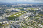
Toronto has experienced significant urban growth over the past century, expanding beyond its historic core into a network of regional centers. Yet one large site, northwest of downtown, has remained largely undeveloped.

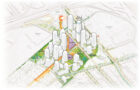
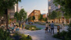
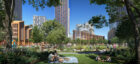
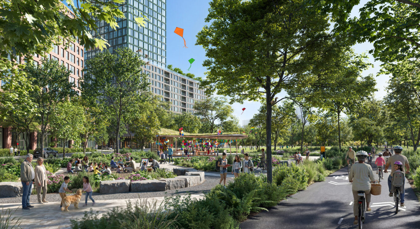
Following the 2018 sale of the 370-acre former Downsview Airport site, Northcrest Developments—lead developer of the site now known as YZD—collaborated with neighboring landowner Canada Lands Company to create a comprehensive master plan for the redevelopment of approximately 500 acres of contiguous, transit-connected land. The resulting Framework Plan outlines an ambitious long-term vision and helped inform YZD, a new urban neighborhood seamlessly integrated with transit and open spaces, designed to accommodate more than 60,000 residents.

Aerial of YZD, looking north © Northcrest Developments

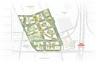
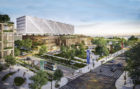
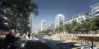
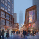
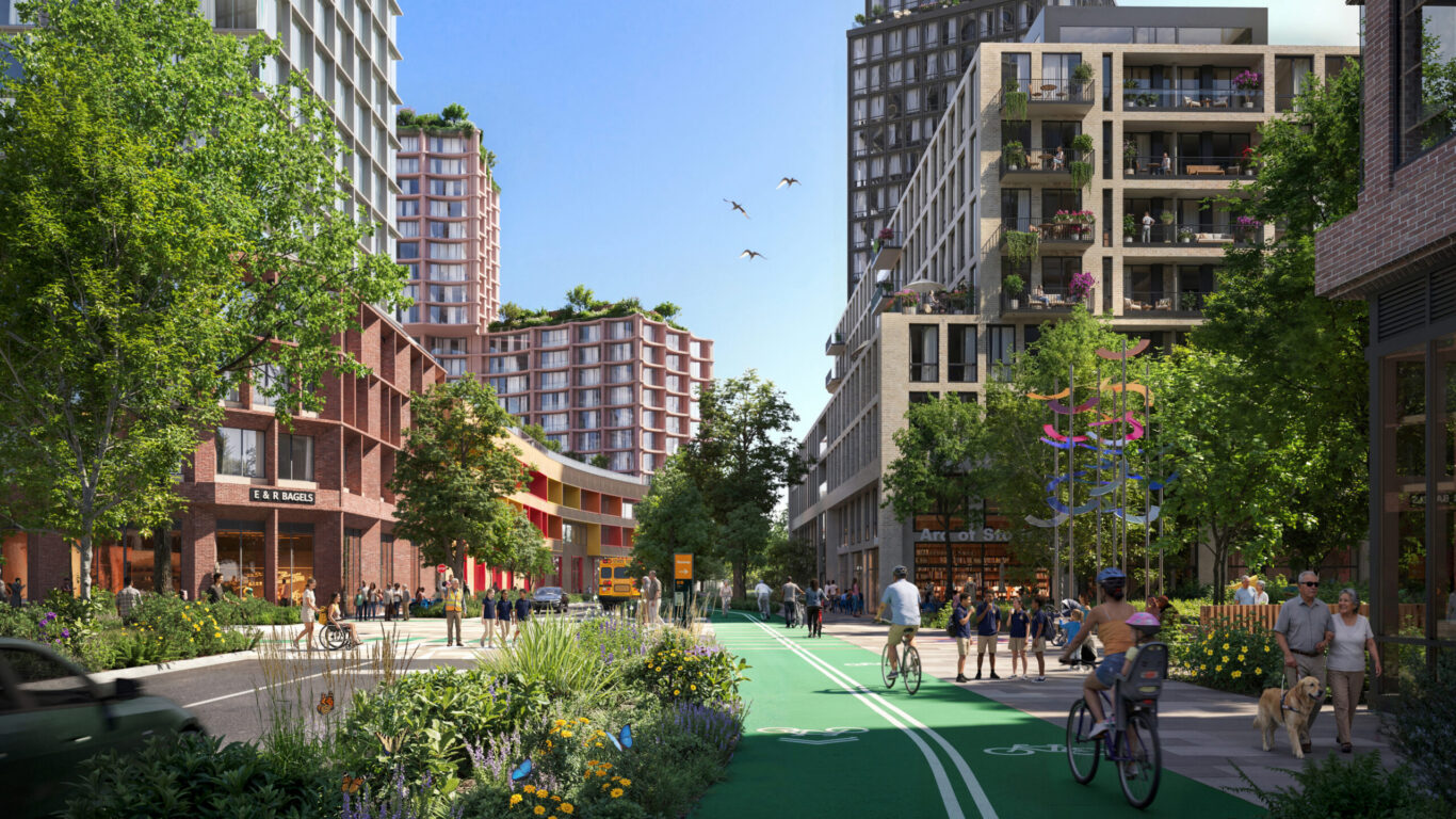
SOM is leading the master plan for the Wilson District, the second district to emerge within the 370‑acre YZD redevelopment. Positioned at the southern edge of the reimagined Runway and directly connected to the Wilson subway station, the district functions as both a transit‑first neighborhood and a critical threshold—where city, movement, and the future YZD landscape converge.

The master plan defines a flexible framework for growth and establishes a set of urban design guidelines while promoting excellence in the design of the public realm, mobility, community building, and sustainability and resilience. The scale and complexity of the project required an integrated, multidisciplinary approach. SOM is leading a large multi-disciplinary team of collaborators including landscape architects, engineers and mobility planners, climate specialists, and Indigenous advisors, to align technical performance with long-term urban goals.

Wilson District Vision © SOM
Site Plan © SOM

Creating a distinctive sense of place

The Wilson District spans 59 acres—44 of which are Northcrest-led—and includes five distinct areas: The Arc, Parkside, Wilson Commons, Wilson Avenue, and Transit Station. Each contributes to a diverse yet cohesive urban experience. At the heart of the district, The Arc forms a pedestrian-focused cultural corridor, extending from the reimagined runway to Wilson Station. The corridor is surrounded by a rich mix of community amenities and spaces planned to contribute to a strong civic identity, including a public library, a cultural building, and a variety of retail offerings.

The character and scale of buildings vary across the district, with higher density and taller buildings concentrated near transit and a gradual transition to more modest and lower scales toward neighboring communities and future Runway districts. This approach balances density and local compatibility, supporting job creation, diverse housing opportunities, community buildings, and long-term growth.

The Runway Northcrest Developments

Establishing a verdant, transit-oriented public realm

The Wilson District is designed to make walking, transit, and cycling the most convenient and efficient ways to move within and beyond the district. A safe and attractive network of streets, cycling paths, and pedestrian routes orchestrate movement across the site and seamlessly connect to the Wilson Station. The former Runway within the district is reimagined as a large, and vibrant pedestrian-only promenade animated with retail, amenities and programmed outdoor space. 

On the eastern edge of the District, parallel to the Runway, the introduction to the Green Spine—a 3 kilometer active transportation route—adds a second north-south corridor with an immersive landscape. The Green Spine is part of the larger landscape vision that the Framework Plan defines as “City Nature”—an interconnected system that combines stormwater management, habitat creation, as well as pedestrian and bike movement to support environmental performance, foster climate resilience, and establish a distinct sense of place honoring the site’s Indigenous past. For the Wilson District, SOM built upon this vision by introducing eight acres of new parks, open spaces, and green corridors incorporating diverse plantings to promote biodiversity, absorb stormwater, and mitigate the urban heat island effect. The layout of these spaces was further guided by environmental analysis for wind, shade, and solar exposure to ensure adequate sunlight and optimize comfort across Toronto’s four-season climate.

These mobility and landscape strategies are reinforced by broader climate objectives, including reducing greenhouse gas emissions through efficient building design, material selection, and a transit-oriented development pattern, contributing to a master plan that is both high performing and adaptable over time.

More Projects

01/