The Point

Rendering of people gathered in green open space
A streetscape rendering of Utah's The Point shows that infrastructure for multiple modes of mobility can exist side-by-side.

Situated at the heart of Utah’s Silicon Slopes, The Point is envisioned as a walkable, transit-oriented community. SOM led the Framework Plan process that will serve as the backbone for this sustainable development.

Project Facts
  • Design Finish Year 2021
  • Size Site Area: 607 acres Building Gross Area: 16,230,808 square feet
  • Collaborators
    Design Workshop WSP Hales Engineering Somers-Jaramillo & Associates Inc. Sam Schwartz Great Basin Engineering
Project Facts
  • Design Finish Year 2021
  • Size Site Area: 607 acres Building Gross Area: 16,230,808 square feet
  • Collaborators
    Design Workshop WSP Hales Engineering Somers-Jaramillo & Associates Inc. Sam Schwartz Great Basin Engineering

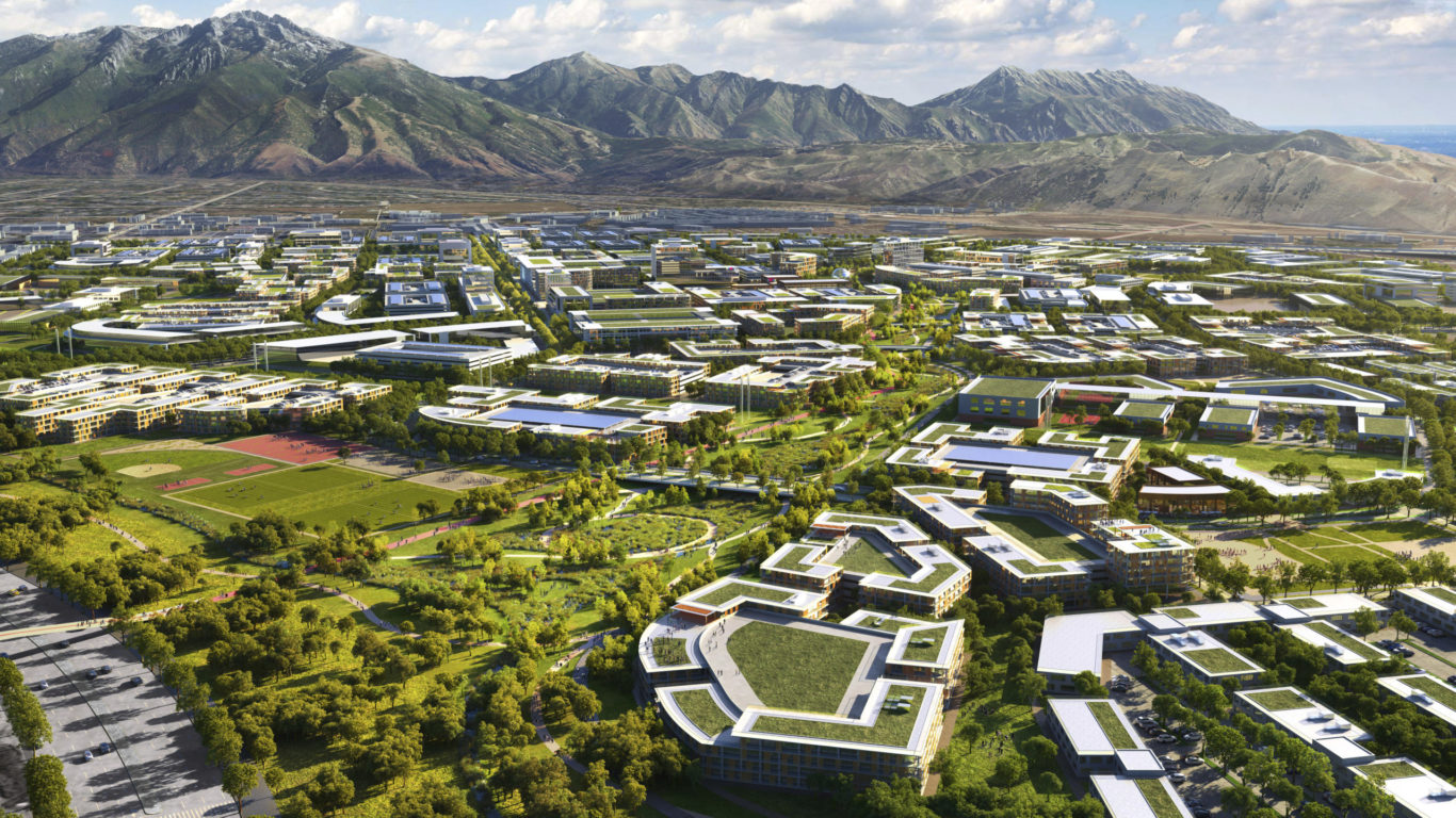
Planning a walkable community

The Point will create an innovation community that is grounded in the specific character of the Wasatch Front, Utah’s most important urban region. Planned on a 600-acre site nestled between Utah’s two most populous counties and largest labor sheds, The Point is the future home for approximately 15,000 residents. A robust public engagement process saw over 10,000 Utahns provide feedback. An economic analysis from The Kem C. Gardner Policy Institute estimates that The Point’s Framework Plan will create 46,500 jobs, $4.4 billion in annual earnings and $7 billion in annual GDP. The Point will be a community for everyone—a place that is connected to the region’s history, while advancing a 21st-century model for sustainable urban design.


An innovation and technology district

More than just a new residential district, The Point seeks to attract businesses and talent to create an innovation hub for Utah. A mix of uses is planned throughout the site to promote activity throughout the day and establish a vibrant community. Development, community facilities, and day-to-day amenities are concentrated in a central area called the Hub District, around the BRT stations, and in the neighborhood and district cores to reinforce transit-oriented development over time. Ninety-five percent of all development is within a five-minute walk of the mixed-use neighborhood cores. Additionally, a retail and entertainment center in the Hub District will become a regional destination.

A streetscape rendering of Utah's The Point shows that infrastructure for multiple modes of mobility can exist side-by-side.
The Point's Innovation Hub. © SOM

A “one-car community”

The Framework Plan for The Point reduces the need for individual car use by offering several convenient transit alternatives. Mobility modes will include Bus Rapid Transit (BRT), a “Circulator” transit loop, a pedestrian priority zone, and a comprehensive network of bike and pedestrian routes that extend beyond the project boundary. The BRT stations have been located to serve the high-density, mixed-use portions of the Framework Plan, and the Circulator complements this system to provide public transit throughout the development. The 80-acre pedestrian priority zone encompasses the Hub District while balancing automobile access by creating a road system that provides multiple connections with major access roads and a permeable system throughout. These strategies will encourage residents and visitors to be less dependent on cars—reducing environmental impact while promoting health and well-being.

A streetscape rendering of Utah's The Point shows that infrastructure for multiple modes of mobility can exist side-by-side.
The Light Rail/BRT system will connect to the high-density mixed-use center of The Point, allowing commuters easy access from adjacent communities to the job centers, intermodal connections and retail uses in the core area. © SOM

Interconnected open spaces

The Point provides more than 142 acres of public open space—approximately one-quarter of the site. Interconnected parks and greenways will provide opportunities for recreation, leisure, and connectivity. The signature open space feature is the River to Range Greenway, which connects the Jordan River in the west to the Wasatch Range in the east. The Central Park creates a recreational and civic heart of the community. Every development parcel is connected to the open space network, enhancing quality of life for residents and boosting the project’s economic value.

More Projects

01/